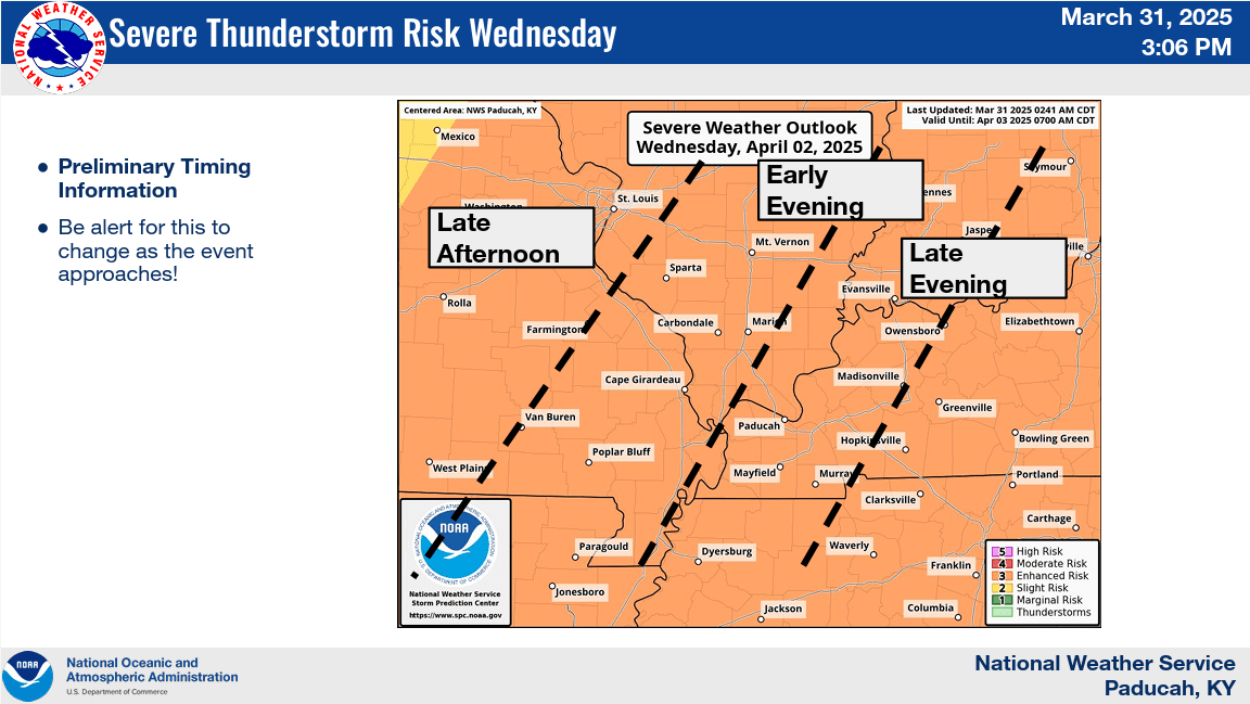
Significant and potentially historic rainfall totals are forecast for Wednesday, with all of western Kentucky under an enhanced risk for severe weather.
Senior forecaster Justin Gibbs says a frontal boundary will enter the region on Wednesday and stay stationary through Saturday. He says there is a threat of severe weather Wednesday evening and Wednesday that could carry over into Thursday.
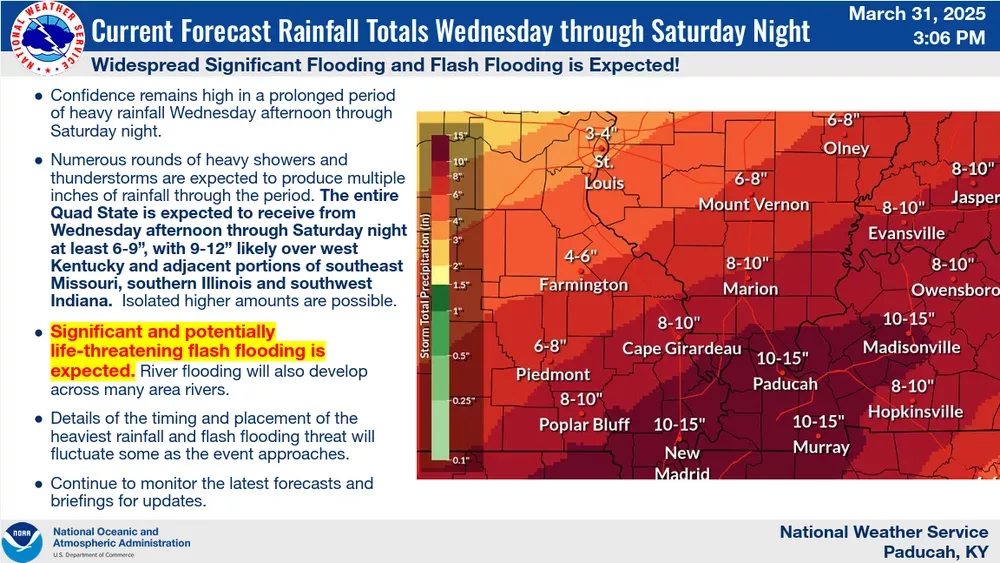
click to download audioNumerous rounds of heavy showers and thunderstorms are expected to produce multiple inches of rainfall through the period, with Gibbs calling it extraordinary.
click to download audioRainfall totals could be as high as 12 inches along the Western Kentucky Parkway and former Pennyrile Parkway corridors. Areas to the east could receive as much as eight inches.
Rainfall totals for the Wednesday afternoon to Wednesday night time frame are 2 to 3.5 inches, with another 1.25 to 3.5 inches falling on Thursday. Gibbs says isolated higher amounts are possible.
He adds that anything you can do before Wednesday to help with drainage on your property would be beneficial.
click to download audioGibbs says significant and potentially life-threatening flash flooding is expected, and river flooding will also develop.
The National Weather Service has issued a flood watch from Wednesday afternoon through Sunday morning for western Kentucky.